Georgia’s land survey requirements come from two places. O.C.G.A. § 15-6-67 defines a plat as “a drawing prepared by a land surveyor that describes and depicts real property boundaries” and lists what a plat must show before a clerk records it. The technical standards of the Georgia Professional Engineers and Land Surveyors Board, Ga. Comp. R. & Regs. 180-7, say how a surveyor ties a parcel to its record title and what must be reported on the drawing. In Lumpkin County a plat also has to clear the Planning Department before the Clerk will record it.
Who may survey land in Georgia
A professional land surveyor must hold a current license issued by the Georgia Professional Engineers and Land Surveyors Board (O.C.G.A. § 43-15-2). The statutory plat definition reaches well past subdivision maps: it includes “a map, condominium plat, subdivision plat, as-built survey, easement survey, or retracement survey.”
What a recordable Georgia plat must show
Among its required data, § 15-6-67 calls for “All applicable land lots, land districts, sections, reserves, or militia districts wherein the platted property lies.” The board’s standards add duties that matter to anyone buying land:
- Georgia survey standards say every surveyed parcel should be made to conform with its record title boundaries. Ga. Comp. R. & Regs. 180-7
- Georgia surveyors must check conformity with adjoining tracts and report overlaps and gores on all maps, plats and reports. Ga. Comp. R. & Regs. 180-7
- Georgia's survey technical standards require plats to show apparent encroachments and observed evidence of human burials or cemeteries. Ga. Comp. R. & Regs. 180-7
- When a survey cannot match record title, the surveyor must explain why; listed reasons include disputed lines, possession lines, acquiescence, adverse possession, unrecorded deeds and vague deed descriptions. Ga. Comp. R. & Regs. 180-7
One more line deserves a slow read on any retracement plat. Its required certification says: “RECORDATION OF THIS PLAT DOES NOT IMPLY APPROVAL OF ANY LOCAL JURISDICTION, AVAILABILITY OF PERMITS, COMPLIANCE WITH LOCAL REGULATIONS OR REQUIREMENTS, OR SUITABILITY FOR ANY USE OR PURPOSE OF THE LAND” (O.C.G.A. § 15-6-67). A recorded retracement is a picture of a boundary, not a building approval.
Land lots, districts and sections
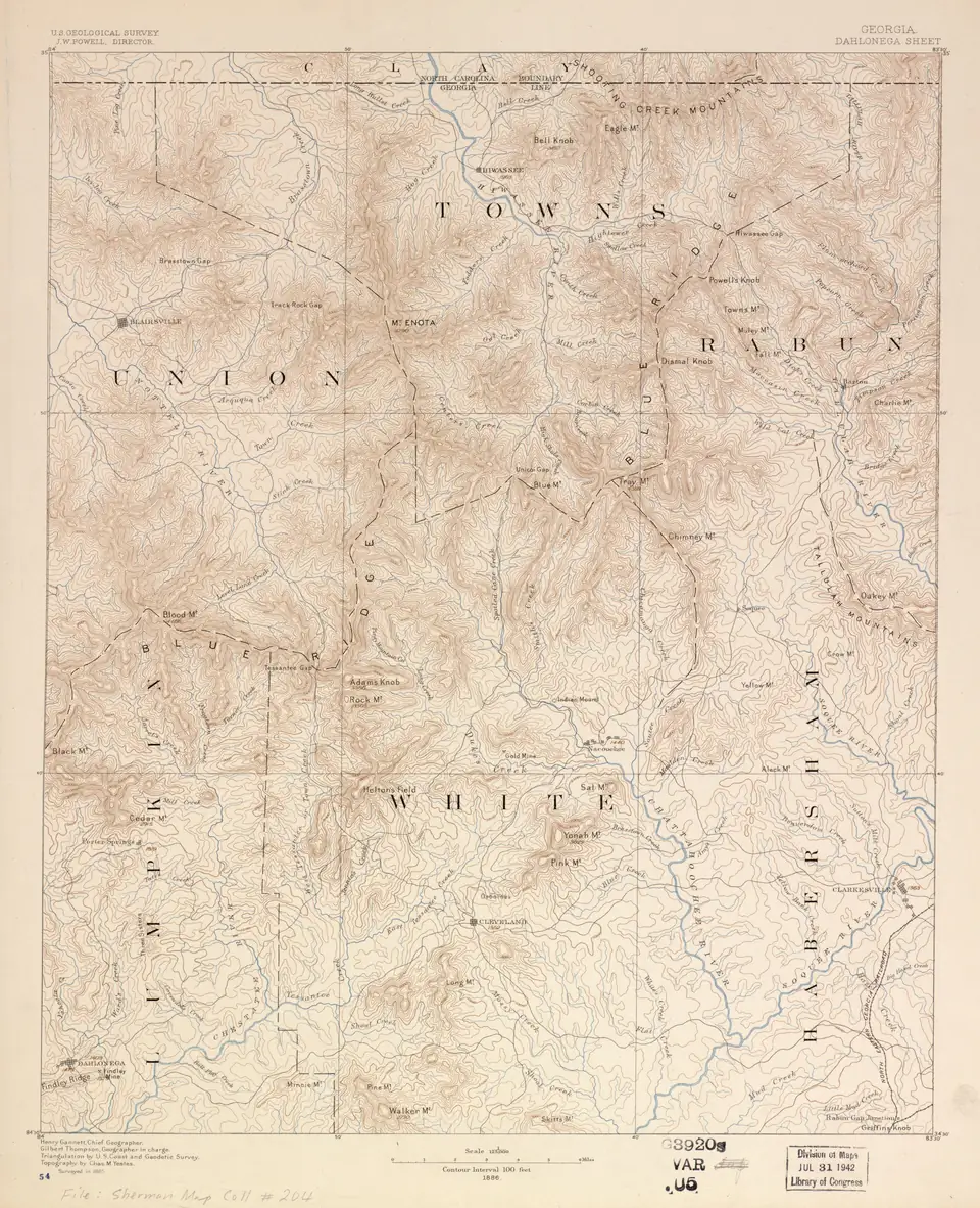
Lumpkin County descriptions read differently from city lots because of how the land was first granted. The Cherokee territory was divided into four sections, each divided into districts, with 33 gold districts (Georgia Archives). About a third of the 160-acre land districts were laid out as gold districts of 40-acre lots and given out in a separate lottery. Georgia’s survey standards still require a written description to call out “The land lot, district, section, militia district number (in Headright Grant areas), city (if known to be within the city limits) and county.”
When an old deed’s calls cannot be matched on the ground, the standards list “dubious and nebulous deed descriptions” among the reasons a surveyor must report. Our guide to reading a Lumpkin County legal description takes a description apart line by line, and Lumpkin County deed records shows where to find the deeds and plats in your chain of title.
Recording a plat in Lumpkin County
| Step | Rule | Source |
|---|---|---|
| Planning review | Plats “need to be reviewed and approved by the Lumpkin County Planning Department before they can be recorded” | Lumpkin County FAQ |
| Review fee | $35.00 per plat, paid before review | Lumpkin County Planning |
| Planning Commission | Final plats for Class II subdivisions and above are reviewed and approved by the Planning Commission, which meets the second Monday of each month at 5:30 p.m. | Lumpkin County Planning |
| Clerk’s check | The clerk “shall not file or record a plat of a subdivision that does not have proper approval” | Lumpkin County Code |
| Electronic filing | Plats have been e-filed through GSCCCA since January 1, 2017, at 300 DPI; a public filing computer is in the Clerk’s office | Lumpkin County Clerk |
| Searching later | The GSCCCA plat index covers plats filed in all Georgia counties since at least January 1, 2004 | GSCCCA |
The plat matters after closing too: a new-home building permit in the county requires a recorded plat of the property (Lumpkin County FAQ). Inside Dahlonega city limits, a minor final plat caption must show the county, land district and land lot (City of Dahlonega).
Lumpkin County Planning and Development
Plat review and approval before recording, subdivision rules and private road applications (unincorporated county).
342 Courthouse Hill, Suite A, Dahlonega, GA 30533
Official page · Source: Lumpkin County, checked Oct 19, 2026
Lumpkin County Clerk of Superior Court
Records deeds, security deeds, plats and liens; copies of recorded deeds and plats.
325 Riley Road, Room 108, Dahlonega, GA 30533
Monday through Friday 8 a.m. to 5 p.m. Excluding holidays.
Official page · Source: Lumpkin County, checked Oct 19, 2026
The survey exception in your title policy
Title insurance and surveys meet in three places in the 2021 ALTA Owner’s Policy.
- Covered Risk 2.c covers encroachments, boundary line overlaps and similar matters “but only if” they “would have been disclosed by an accurate and complete land title survey of the Land.”
- Exclusion 7 removes coverage for “Any discrepancy in the quantity of the area, square footage, or acreage of the Land or of any improvement to the Land.” Land sold as a stated number of acres is not insured as that number.
- ALTA publishes Endorsement 25-06, Same as Survey. Ask the closing attorney whether it is available on your file.
The commitment’s Schedule B, Part II lists exceptions that remain in the policy “unless cleared to the satisfaction of the Company.” Whether a current survey lets the insurer remove or narrow a survey-related exception is the insurer’s decision under that language, so a survey ordered after the commitment is final may come too late to change it. See how to read a title commitment.
Flood zones and stream buffers
FEMA defines a Special Flood Hazard Area as “the area that will be inundated by the flood event having a 1-percent chance of being equaled or exceeded in any given year,” and labels areas of minimal flood hazard Zone C or Zone X (unshaded) (FEMA). FEMA’s National Flood Hazard Layer lists 30 Lumpkin County map panels, all effective April 4, 2018 (FEMA NFHL), while the county’s flood ordinance still adopts the Flood Insurance Study dated April 2, 1991 “and any revision thereto” (Lumpkin County Code).
Streams carry their own setbacks. Lumpkin County Planning states that “Stream buffers are 25 feet for warm water streams and 50 feet for Primary and secondary trout waters” (Lumpkin County FAQ), and land inside a buffer cannot be disturbed without a variance from the Georgia Environmental Protection Division (Lumpkin County FAQ). The county erosion ordinance keeps in force the state buffers “of at least 25 feet” set under the Georgia Water Quality Control Act (Lumpkin County Code). A survey that plots streams, together with county GIS layers that include 2-foot LiDAR contours and streams (Lumpkin County GIS), shows how much of a tract sits inside those lines.
Questions to ask the surveyor
- Is this a new boundary survey or a retracement of an existing plat?
- Will the plat show every road, path and utility line in use, recorded or not?
- Will it show any “observed evidence of human burials or cemeteries”? See family cemeteries on private land.
- Will it report overlaps and gores with neighboring tracts, and explain any line that does not match the deed?
- Will it show streams, buffers and the FEMA flood zone line?
- Does it tie to the land lot, district and section named in the deed?
Decision tool · Title Risk Finder
Find the title checks your property needs
Pick who you are, the kind of property and what you already know about the land. You get the checks that apply, where each record lives and the rule behind it. No score and no advice: take the list to the closing attorney you choose.
Want help putting the list in order before you sign? Send it with a note and a licensed Gold Peach Realty agent will follow up.
Send my list with a noteIf the land borders the national forest, boundary questions multiply; see national forest boundaries. Questions about the way in belong with easements and landlocked land. Before relying on a survey for a purchase decision, ask a Georgia real estate attorney how it fits your title commitment.
Questions people ask
Who can do a land survey in Georgia?
A professional land surveyor in Georgia must hold a current license issued by the Georgia Professional Engineers and Land Surveyors Board under O.C.G.A. § 43-15-2.
Source: O.C.G.A. § 43-15-2, checked Oct 19, 2026
What must a recorded plat in Georgia show?
Among other required data, O.C.G.A. § 15-6-67 requires a plat to show all applicable land lots, land districts, sections, reserves or militia districts where the property lies.
Source: O.C.G.A. § 15-6-67, checked Oct 19, 2026
Does a plat need county approval before recording in Lumpkin County?
Yes. Lumpkin County says plats need to be reviewed and approved by the county Planning Department before they can be recorded in the Clerk of Courts office.
Source: Lumpkin County FAQ, checked Oct 19, 2026
Does title insurance cover boundary line problems?
Under the 2021 ALTA Owner's Policy, encroachments and boundary line overlaps are covered only if an accurate and complete land title survey would have disclosed them, and the policy's exceptions still apply.
Source: 2021 ALTA Owner's Policy, checked Oct 19, 2026
Does an owner's title policy cover a shortage in acreage?
No. Exclusion 7 of the 2021 ALTA Owner's Policy removes coverage for any discrepancy in the area, square footage or acreage of the land or its improvements.
Source: 2021 ALTA Owner's Policy, checked Oct 19, 2026
How wide are stream buffers in Lumpkin County?
Lumpkin County Planning states that stream buffers are 25 feet for warm-water streams and 50 feet for primary and secondary trout waters, and land inside a buffer cannot be disturbed without a variance from the Georgia Environmental Protection Division.
Source: Lumpkin County FAQ, checked Oct 19, 2026
Does recording a plat mean the county approved the land for building?
Not for a retracement plat. Its required certification states that recording it does not imply local approval, availability of permits, compliance with local rules or suitability for any use.
Source: O.C.G.A. § 15-6-67, checked Oct 19, 2026